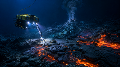
More than two kilometres beneath the surface of the Pacific, off the coast of Oregon, an active underwater volcano has been hiding one of the strangest landscapes ever mapped on the seafloor. Using robotic vehicles capable of withstanding crushing depths, scientists from the Monterey Bay Aquarium Research Institute have spent more than two decades surveying Axial Seamount, a volcano along the Juan de Fuca Ridge that has erupted repeatedly since its discovery in the 1980s. According to the study published in Advancing Earth and Space Sciences, titled ‘Voluminous Inflated Lobate Flows on the Distal Rift Zones of Axial Seamount, Juan de Fuca Spreading Ridge’, three enormous lava flow fields on the volcano’s distant flanks, each far larger than anything previously recorded at Axial or elsewhere on the global mid-ocean ridge system. These flows formed as molten rock pooled beneath a hardened crust, swelled to extraordinary thickness, and eventually burst outward, reshaping the ocean floor and offering fresh clues about the volcano’s history of caldera collapse.
How did MBARI’s deep-sea robots map Axial Seamount
For more than twenty years, teams from MBARI’s Seafloor Mapping Lab and Submarine Volcanism Team have repeatedly returned to the Juan de Fuca Ridge, a 500-kilometre volcanic mountain range in the northeast Pacific. Their tools of choice were autonomous underwater vehicles (AUVs), which glide independently across the seafloor gathering high-resolution sonar data, and remotely operated vehicles (ROVs), which are piloted from a ship above and used to collect rock sediment samples.According to a Monterey Bay Aquarium Research Institute official press release, this combination allowed researchers to build detailed maps of the seafloor while also gathering direct evidence of what lay beneath it. The study’s lead author, Jennifer Paduan, and colleagues, including David Clague, David Caress, Ryan Portner, Morgane Le Saout and Brian Dreyer, drew on thirteen separate AUV surveys carried out between 2011 and 2021, alongside multiple ROV dives dating back to 2005, to piece together a picture that had previously eluded scientists studying the volcano.
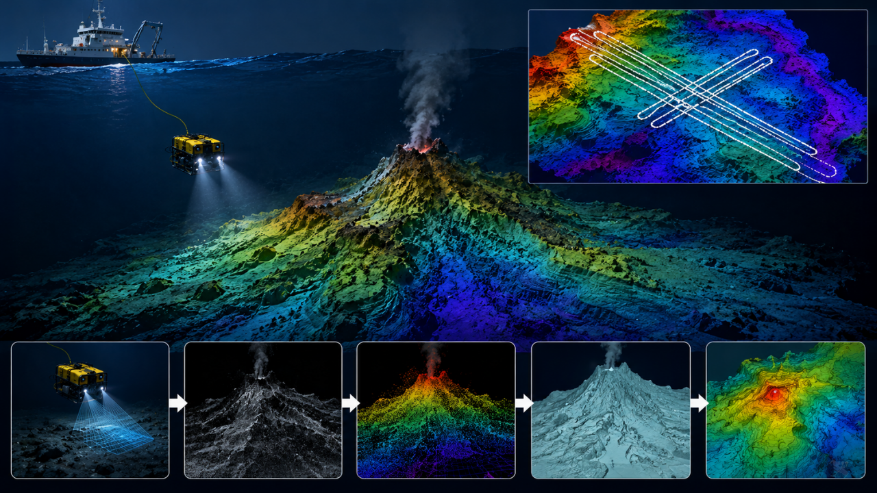
Image AI generated
How huge are Axial Seamount’s newly discovered lava fields
Researchers identified three “voluminous inflated lobate flow” complexes on Axial Seamount’s distal rift zones, each between 65 and 100 square kilometres in area and up to 130 metres thick. According to the study, these flows are almost 100 times larger in volume than any of the volcano’s historical eruptions, and dwarf comparable flows recorded anywhere else along the global mid-ocean ridge system.One of the three fields contains a feature the authors say has no clear parallel anywhere on Earth, submarine or otherwise: a cluster of deep, interconnected lava ponds bordered by levees rising more than 100 metres high. Radiocarbon dating of foraminifera recovered from sediment cores places the youngest of the three fields at roughly 1,259 years old, while the oldest is thought to be around 25,000 years.
Why did the lava flows swell and burst outward
The process behind the flows’ formation began when advancing lava stalled on gentle slopes and cooled at its surface, forming a hardened outer crust. Beneath that crust, however, the lava’s molten core kept moving, continually fed from below. As pressure built, the flow inflated upward and outward, thickening far beyond what a typical eruption would produce, until the crust could no longer contain it and the lava spilt over its own margins.This cycle of pooling, swelling and overflow repeated itself across the three fields, eventually producing the deep collapse pits and levee walls now visible in the seafloor maps. In one dramatic case, a wall enclosing one of the deep lava ponds gave way entirely, releasing a fresh surge of molten rock that carved out a new flow across the surrounding terrain.
When could Axial Seamount erupt again
Perhaps the most significant conclusion concerns the volcano’s broader history. The timing of the youngest lava field’s eruption lines up almost exactly with evidence of an explosive collapse of Axial Seamount’s summit caldera, both dated to around 1,200 years ago. The researchers argue that the sheer volume of lava draining from the summit’s magma reservoir into the distal rift zones was likely enough to destabilise the ground above it, causing the roof of the magma chamber to give way.The two older lava fields may point to earlier caldera collapses that occurred similarly, suggesting the volcano cycles through such events roughly every 12,000 years. With that pattern in mind, the researchers estimate the next major caldera-forming eruption at Axial Seamount may still be thousands of years away; continued monitoring of the site remains a priority for understanding how underwater volcanoes reshape the ocean floor.