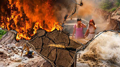
Many people expected El Niño to become a major factor later in the year, particularly as it strengthened towards the winter months.But signs of the phenomenon had begun appearing much earlier.Months before the expected winter peak, several parts of the world were already experiencing unusual weather. Extreme heatwaves appeared earlier than normal. Rainfall became erratic in several regions. Ocean currents and temperatures also began shifting.According to the World Meteorological Organization (WMO), sea surface temperatures in the tropical Pacific began moving above normal baseline levels early in the summer. By June, the US National Oceanic and Atmospheric Administration (NOAA) had officially issued an El Niño Advisory.The advisory indicated that the warmer-than-normal Pacific Ocean was no longer acting on its own. The warmer water was beginning to interact with the atmosphere, increasing the possibility of wider changes in global weather patterns.In other words, El Niño conditions had developed much earlier in the year, even though the phenomenon was expected to strengthen towards the end of 2023.
The normal Pacific: How the system usually works
To understand why El Niño can have such a wide impact, it is first important to understand what normally happens in the tropical Pacific Ocean.As the National Oceanic and Atmospheric Administration (NOAA) explains, under normal conditions, strong winds called trade winds blow from east to west along the equator.These winds generally move from the waters near the western coast of South America towards Asia and Australia. They push warm surface water towards Southeast Asia and northern Australia. Over time, a large pool of warm water builds up in the western Pacific.At the same time, the movement of surface water allows colder water from deeper parts of the ocean to rise towards the surface near the coast of South America.This process is known as upwelling.The cold water that rises to the surface is also rich in nutrients. It supports marine ecosystems and helps make the waters off parts of South America highly productive fishing grounds.The warmer western Pacific also influences the atmosphere above it.Warm ocean water causes air above the surface to become warmer and more humid. That air rises and contributes to cloud formation and rainfall.This means the normal Pacific system helps establish a broad pattern in which the western Pacific receives significant rainfall, while parts of the eastern Pacific remain comparatively cooler and drier.
El Niño changes the balance
During an El Niño event, this normal arrangement begins to break down.The trade winds that normally push warm water towards Asia and Australia become weaker. In some cases, they can almost stop or even temporarily reverse.That change may sound small, but it can have consequences across a huge part of the planet.When the trade winds weaken, they are no longer able to keep the large pool of warm surface water concentrated in the western Pacific.The warm water begins moving eastward, towards the coast of South America.This is sometimes described as the warm water “slosh” moving across the Pacific.The movement of this warm water changes where heat and moisture are concentrated over the Pacific.The ocean and atmosphere are closely connected.When a large area of the tropical Pacific becomes warmer than usual, the atmosphere above it also responds. Rising warm, moist air changes patterns of clouds, rainfall and pressure.These changes can then influence jet streams, which are fast-moving currents of air high in the atmosphere.Jet streams help guide weather systems around the planet. When their position or strength changes, areas far away from the Pacific can experience unusual weather.This is why El Niño is not simply a Pacific Ocean phenomenon. Its effects can spread across continents.
Weather disruptions emerge as El Niño develops
As El Niño developed during 2023, several regions experienced major weather disruptions. El Niño was one of several factors influencing these patterns, alongside other regional weather systems and the broader effects of climate change.Three broad developments stood out.
India’s stalled monsoon
India’s southwest monsoon began with its onset over Kerala on June 8, according to the India Meteorological Department (IMD).However, the monsoon’s progress subsequently slowed.The IMD had warned that developing El Niño conditions could influence the broader monsoon pattern. As El Niño strengthened during the season, it added pressure to India’s monsoon system.By August, central and northern parts of India experienced a significant dry spell. August rainfall was particularly weak, with the month recording only around 64% of its long-period average rainfall.This mattered because the June-to-September monsoon is extremely important for India.Farmers depend on monsoon rainfall for sowing and crop growth. Rain also replenishes reservoirs, groundwater and other water sources.A prolonged break in rainfall can therefore affect not only agriculture but also water availability and food supplies.
Extreme heatwaves
Spring and early summer also brought unusually intense heat to several parts of the world.North America, Southern Europe and South Asia experienced prolonged heatwaves during 2023. El Niño developed against this backdrop of unusually high global temperatures and was expected to further increase the likelihood of extreme heat as it strengthened.Heatwaves, when lasting for several days or weeks, increase pressure on electricity systems because of greater demand for cooling. They can also affect crops, water supplies and public health.
Water and trade disruptions
The effects were not limited to temperatures and rainfall.In Central America, rainfall deficits reduced water availability in the watershed supplying the Panama Canal.The canal depends on freshwater to operate its locks. When water levels fall, authorities may have to reduce the amount of cargo ships can carry.The Panama Canal Authority said 2023 was exceptionally dry, with accumulated rainfall in its watershed around 25% below the long-term average.That means a change in rainfall can eventually affect international trade.Ships carrying goods between major global markets may have to reduce their loads or wait longer to pass through the canal.The disruption showed how a weather pattern that begins thousands of kilometres away can eventually affect global supply chains.
What exactly is El Niño?
El Niño is part of a larger climate system involving interactions between the ocean and atmosphere.At its simplest, it can be understood as a period when the central and eastern tropical Pacific becomes unusually warm and the normal relationship between ocean temperatures, winds and rainfall changes.How world is experiencing the impactThe impact of El Niño has been observed through weather stations, ocean measurements, satellite data and climate monitoring systems.
India: Monsoon stresses and domestic policy shifts
India provides a clear example of how changes in the climate system can affect agriculture, water supplies and government policy.The country depends heavily on the southwest monsoon, which normally lasts from June to September.The monsoon is important not only because it brings rain.It also helps farmers grow crops, replenishes groundwater and fills reservoirs used for drinking water, irrigation and other needs.
Rainfall deficits
According to reports from the India Meteorological Department (IMD), the monsoon did not progress evenly.During early June, rainfall deficits were recorded in parts of central and eastern India.Later, August brought an extended dry spell.
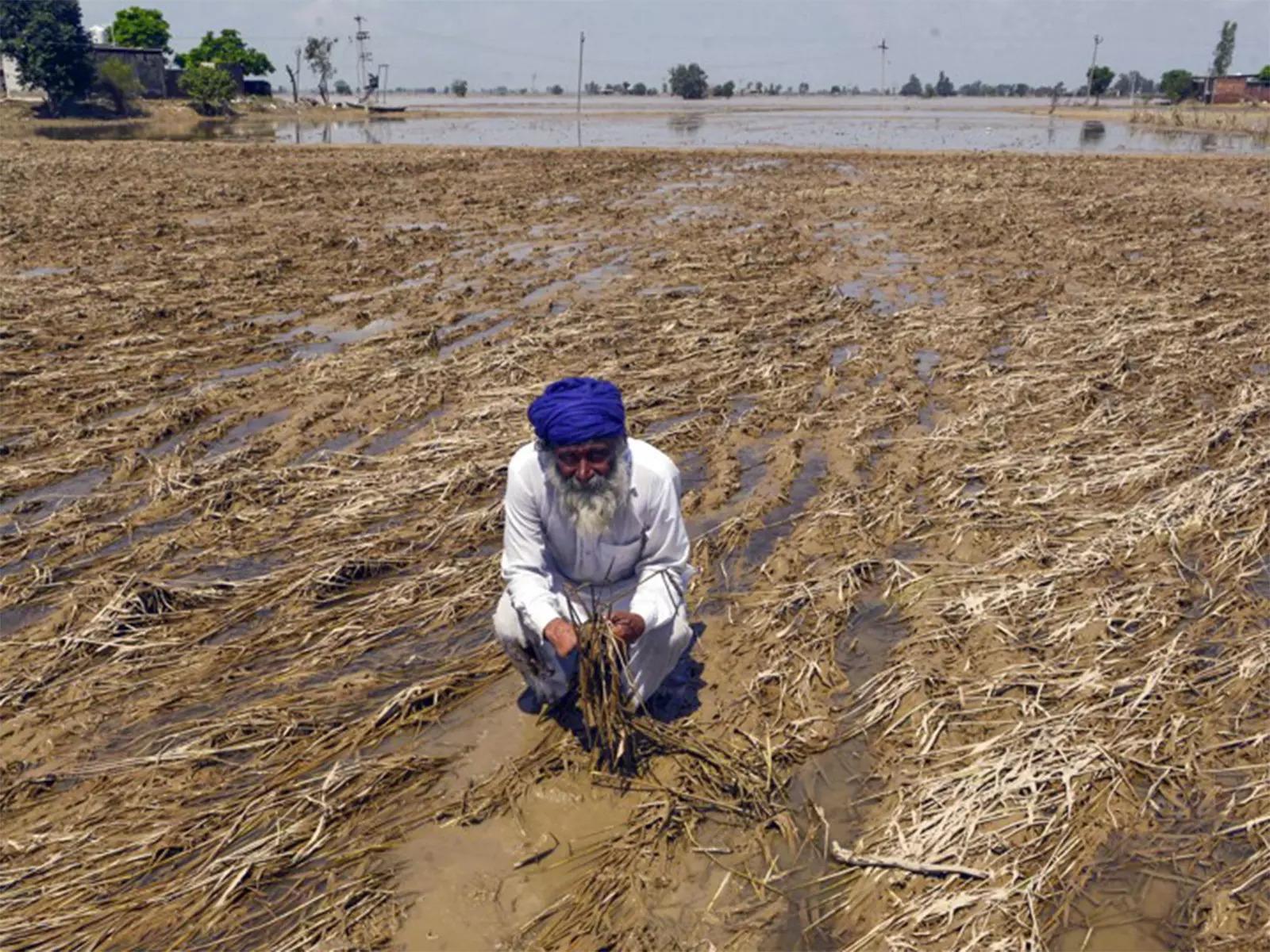
Mixed rainfall in India’s agricultural regions resulted in floods and deficits which ultimately raised food inflation risk
Such breaks in rainfall can be particularly difficult for rain-fed agriculture.Crops such as paddy, pulses and oilseeds depend on adequate rainfall, particularly during important stages of their growth.When rain stops for an extended period, farmers may have to change sowing schedules or rely more heavily on irrigation.
Reservoir levels
Water storage was another concern. The Central Water Commission (CWC) monitors water levels in India’s major reservoirs.It tracks storage across major reservoirs, providing an important indicator of the country’s available water resources.As the monsoon progressed, storage levels in several southern states fell significantly below normal levels. By October, CWC data showed substantial deficits in states including Tamil Nadu, Karnataka and Kerala.
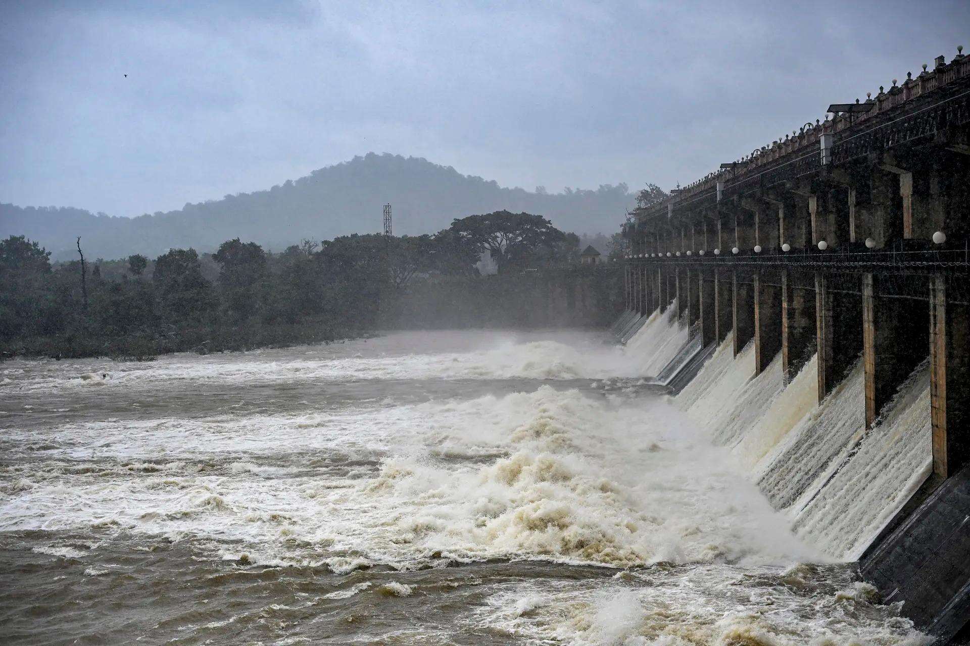
Water is released from the Tunga Reservoir (Gajanur Dam) in May following rainfall in the catchment area, at Gajanur, in Shivamogga district, Karnataka.
Lower reservoir levels can have consequences beyond drinking water.They can affect irrigation, electricity generation and the availability of water for cities and industries.
Agricultural safeguards
The rainfall pattern also affected farmers.According to the ministry of agriculture and farmers welfare, dry spells forced farmers in states including Maharashtra, Karnataka and Odisha to adjust their sowing schedules.The government also took steps during the period to protect domestic food supplies and control food inflation.Exports of non-basmati white rice were prohibited in July 2023, with the government citing factors including extreme climatic conditions and concerns linked to El Niño. Onion export restrictions were tightened later in the year as domestic prices rose and supplies came under pressure.
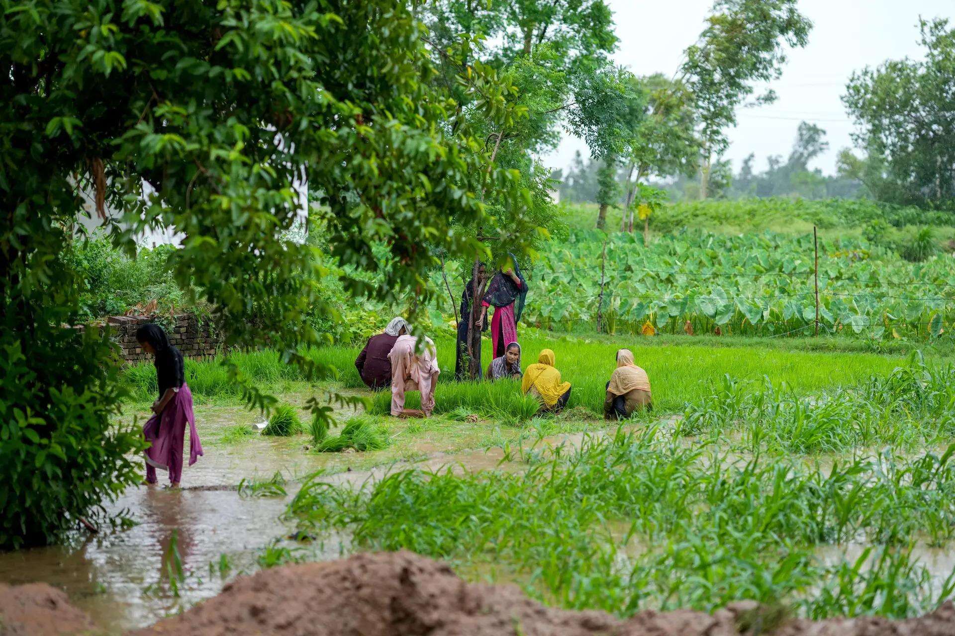
Farmers plant grains in a paddyfield as it rains outskirts of Sambhal district in July in the northern Indian state of Uttar Pradesh state.
Sugar exports, meanwhile, had already been under restrictions since 2022, with the curbs extended in 2023.This illustrates how weather conditions can eventually contribute to policy decisions.A change in rainfall can affect crops. Lower crop production can affect prices. Rising food prices can then lead governments to intervene in domestic and international trade.
The Indian Ocean counter-buffer
However, India did not experience the worst possible outcome from the El Niño influence.One reason was the development of another climate phenomenon later in the monsoon: the Positive Indian Ocean Dipole (IOD).The IMD noted that the IOD remained neutral through much of the early monsoon before turning positive in the latter part of August. The positive IOD then helped offset some of the drying influence associated with El Niño.The IOD refers to differences in sea surface temperatures between the western and eastern parts of the Indian Ocean.In a positive IOD phase, warmer waters tend to develop in the western Indian Ocean while the eastern part becomes relatively cooler.This can alter rainfall patterns.For India, the positive IOD helped bring conditions that partly compensated for El Niño’s negative influence on the monsoon.India therefore experienced significant monsoon fluctuations, but the positive IOD helped prevent the El Niño influence from producing an even more severe outcome.
Global impacts
Parts of the world experience impacts of El Niño differently. The same broad climate phenomenon can contribute to drought in one region and unusually heavy rain in another.
South America: Peru, Ecuador and Brazil
Parts of South America experienced major changes in rainfall and temperature.According to NOAA’s Climate Prediction Center, ocean temperature anomalies along the coast of Peru rose to more than +3°C above average.That means the water in the region was more than three degrees Celsius warmer than the normal baseline used for comparison.
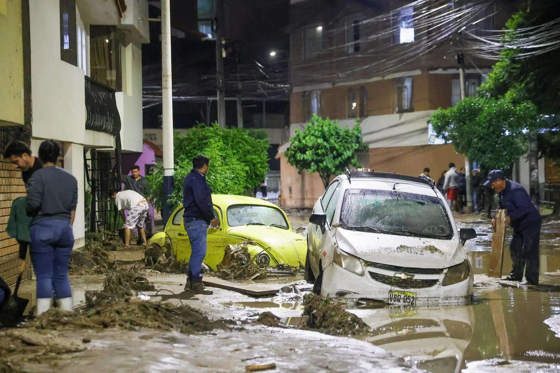
People inspect a destroyed road after heavy rain triggered flooding in Arequipa, Peru.
Such unusually warm water can add heat and moisture to the atmosphere.The result can be increased rainfall.Along parts of the coasts of Peru and Ecuador, this contributed to heavy rain, flooding and severe mudslides.
Amazon rainforest drought
At the same time, the situation farther inland was very different.Parts of northern Brazil and the Amazon basin experienced severe dry conditions.Major tributaries fell to unusually low levels.This highlights one of the defining features of El Niño-related weather disruptions: neighbouring areas can experience very different conditions.One location may receive excessive rainfall while another faces a serious lack of it.
Southeast Asia and Australia
The warming Pacific also affected weather conditions across Southeast Asia and Australia.The World Meteorological Organization (WMO) and regional meteorological agencies in countries including Indonesia, Malaysia and Australia recorded prolonged dry spells.For agricultural communities, a long period without adequate rain can be damaging.Reports from agricultural agencies indicated declines in the production of crops and commodities such as palm oil, coffee and rice.
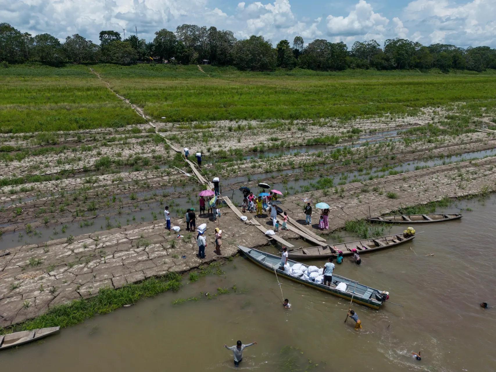
People from the Tikuna Indigenous receive aid from an NGO because of the drought triggered by El Niño along the Amazon River in Santa Sofia, on the outskirts of Leticia, Colombia.
Dry conditions also increase the risk of wildfires.Peatlands and bushland can become much more vulnerable to fire when they remain dry for long periods.A single spark can therefore develop into a large wildfire when vegetation and soil moisture levels are low.
Southern Africa and the Horn of Africa
As the 2023-24 El Niño matured, its effects became increasingly visible in Africa.Data from the United Nations Food and Agriculture Organization (FAO) indicated that countries in Southern Africa, including Zambia, Zimbabwe and Malawi, experienced severe rainfall deficits and drought conditions in early 2024.The lack of rainfall damaged staple maize crops.For communities that depend heavily on maize for food, crop losses can quickly become a serious humanitarian concern.The scale of the agricultural damage led to emergency declarations in some countries.
East Africa sees a different pattern
The situation in East Africa was different.While parts of the region had previously struggled with dry conditions, some areas experienced heavy and unseasonal rainfall.The downpours caused flooding in areas that had been recovering from drought.This again demonstrates why El Niño cannot simply be described as a “drying” or “warming” phenomenon.Its effects depend on the location and on how the changing ocean and atmospheric conditions interact with existing regional weather patterns.
Global temperature records
El Niño’s effects were also observed against a broader backdrop of rising global temperatures.The European Union’s Copernicus Climate Change Service (C3S) reported repeated monthly global temperature records.Global average temperatures also briefly remained above 1.5°C over pre-industrial levels for extended periods.However, a temporary monthly or short-term breach does not mean that the long-term Paris Agreement temperature threshold has been permanently crossed.What the records do show is how unusually warm the planet’s surface and oceans have become.The current El Niño cycle shows just how closely connected the planet’s climate system is.It begins with an unusual change in the tropical Pacific Ocean.Trade winds weaken. Warm water moves eastward. The distribution of heat and moisture across the Pacific changes.The atmosphere responds and those changes can travel far beyond the Pacific. This does not mean every extreme weather event is caused by El Niño alone. Weather is influenced by many interacting factors.But El Niño can significantly change the odds and intensity of particular weather patterns.That is why scientists closely monitor Pacific Ocean temperatures, trade winds, atmospheric pressure and rainfall.The information is not merely about understanding a climate phenomenon. It can help governments and communities plan ahead.Farmers can adjust planting schedules. Water authorities can prepare for lower reservoir levels. Governments can manage food supplies and exports. Disaster agencies can prepare for floods, droughts and wildfires.El Niño is therefore a reminder that when one major part of that system changes, the effects can travel much farther and appear much sooner than expected.