
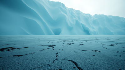
Beneath nearly two kilometres of the East Antarctic Ice Sheet, locked away since the continent froze over at least 34 million years ago, scientists have found something that changes the way researchers understand both Antarctica’s distant past and its near-term future. Using ice-penetrating radar gathered across multiple airborne survey campaigns, an international team led by Durham University has mapped a vast ancient landscape stretching along 3,500 kilometres of the East Antarctic margin, a terrain of 31 separate flat surfaces, formed by rivers that once flowed freely across what is now the most remote and ice-covered continent on Earth. The study, published in Nature Geoscience, is the first to identify these surfaces at this scale, and what the researchers found is not simply a record of a warmer, wetter Antarctica. These buried plains appear to be actively influencing how the ice above them moves today, slowing the flow of glaciers in ways that current climate models have not accounted for, and complicating projections of how much sea level will rise as the world continues to warm.
Before Antarctica froze: How giant rivers shaped a lost continent 80 million years ago
These surfaces, some of which are believed to have formed over 80 million years ago when East Antarctica and Australia were still joined, are thought to have been smoothed by large rivers before the continent was engulfed by ice around 34 million years ago. Remarkably, these landscapes have remained largely intact, preserved beneath the ice sheet for over 30 million years. The picture that emerges from this timeline is striking. When the flat surfaces now buried beneath the ice were first formed, Antarctica was part of the ancient supercontinent of Gondwana, sharing landmass with Australia, South America, and India. As those continents drifted apart, large rivers carved and smoothed the terrain of what would eventually become East Antarctica. It is believed the surfaces were formed by large rivers after East Antarctica and Australia broke apart approximately 80 million years ago, and before ice covered Antarctica about 34 million years ago. When the deep freeze eventually arrived, it functioned, in the words of one researcher, like switching on a freezer, sealing the landscape in place while the rest of the continent was reshaped by glaciation.
How ice-penetrating radar revealed 31 hidden surfaces beneath the East Antarctic Ice Sheet
The discovery relied entirely on a technology that has transformed polar science over the past two decades: airborne radar capable of seeing through kilometres of ice to map the bedrock and terrain beneath. Researchers led by Durham University examined radar measurements of ice thickness and found extensive, previously unmapped, flat surfaces buried beneath a 3,500km stretch of the East Antarctic coastline. The British Antarctic Survey, whose Twin Otter aircraft helped gather the radar data, played a key role in both collecting and interpreting the sub-glacial topography. The landscape consists of 31 separate flat surfaces that together cover an area comparable to the size of Wales. From above the ice, none of this is visible. The surface of the East Antarctic Ice Sheet gives no indication of what lies beneath it. That invisibility is precisely what makes radar the only tool available and precisely why these surfaces went unmapped for so long.
Why these ancient river plains may be slowing Antarctica’s ice loss right now
The most consequential finding of the study is not historical; it is present tense. The flat surfaces are now hidden beneath the ice sheet and separated by deep troughs, which fast-flowing glaciers are steered through. The ice above the surface is moving much more slowly. Dr Guy Paxman, lead author and Royal Society University Research Fellow at Durham University, described the mechanism in the official BAS press release: “These flat surfaces we’ve found are likely the remnants of ancient river beds that have survived beneath the ice. Their shape and position now appear to slow down the movement of ice above them, acting almost like a brake on fast-flowing glaciers.” In practical terms, this means the ancient terrain is functioning as a natural regulator, channelling fast-moving glaciers through the troughs between the flat surfaces whilst the ice directly above the plains moves far more slowly. The implications for sea level projections are significant because models that do not account for this braking effect may be overestimating or mischaracterising how quickly East Antarctica’s ice can reach the ocean.
What 52 metres of potential sea level rise has to do with ancient riverbeds
The stakes attached to this discovery are not abstract. If East Antarctica’s ice were to melt completely, it holds enough frozen water to raise global sea levels by up to 52 metres. That figure represents a worst-case scenario across timescales that extend far beyond any near-term climate projection, but it illustrates why understanding the dynamics of East Antarctic ice loss matters enormously. Even a fraction of that melt driven by accelerating climate change over the coming centuries would reshape coastlines across the planet. Co-author Professor Stewart Jamieson, also from Durham, said that factoring these hidden landscapes into computer models could significantly enhance projections of how Antarctica will respond to warming temperatures. Dr Tom Jordan, a BAS geophysicist and co-author, was direct about the gap the study exposes: “These findings show just how much of Antarctica’s past remains locked beneath the ice. Understanding the ancient landscapes that influence present-day ice flow is crucial if we’re to predict how this huge ice sheet will behave in the future.”
What needs to happen next to unlock the full significance of this discovery
Mapping the surfaces from the air is only the beginning. The researchers stress that further exploration is needed to determine how these flat surfaces influenced ice movement in past warm periods. Drilling to obtain rock samples from beneath the ice could confirm when these regions were last ice-free, vital data for improving climate models. That kind of sub-glacial drilling is technically demanding and expensive, but the scientific reward would be considerable. Rock and sediment samples from beneath the ice could reveal what plants and organisms inhabited the landscape before freezing, confirm the precise timeline of glaciation, and establish whether these surfaces remained stable during warmer interglacial periods in the deep past, information that would directly improve the reliability of models projecting Antarctica’s behaviour under future warming. The study was supported by the UK’s Natural Environment Research Council, the Leverhulme Trust, the European Research Council, and international partners including the Alfred Wegener Institute in Germany and the Polar Research Institute of China.