
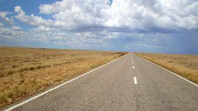
Australia has the world’s longest national highway, which is a marvelous engineering example known simply as ‘Highway 1.’ Spanning approximately 14,500 kilometres, this massive highway covers around the entire mainland continent like a belt, acting as an important transport base that connects every state capital city from Sydney to Perth and Darwin.The Pan-American Highway covers more total distance, but it has the roadless Darien Gap in between, which makes the Highway 1 in Australia as the ‘longest uninterrupted national route’ on Earth. This looping road is not a single highway, but a sophisticated network of connected sealed roads that runs along the vast coastline. It serves as the bloodline for the nation’s commerce, tourism, and travel, by providing a continuous path through tropical rainforests, desolate deserts, and bustling metropolitan centres, which makes the vast Australian continent accessible to everyone.
How the idea of National highway 1 first came together in Australia
According to historical records from Ozroads, Highway 1 was officially established in 1955 as part of the National Route Numbering initiative. Before this, road systems in Australia were largely fragmented and managed independently by various states with little cohesion across borders. The creation of National Route 1 was designed to unify these different paths into a single, national network.For a long time, various parts of this route have been given different names depending on the region, like the Pacific Highway in New South Wales or the Eyre Highway across the Nullarbor, but they all remain part of this singular National highway 1. Ozroads guide explains that the original ‘Route 1’ shields are slowly being replaced by modern alpha-numeric signs, but the highway remains the greatest road of the nation, following the coast for the majority of its journey.
Why National Highway 1 follows the coastline of the Australian continent
The decision to build a circumferential route rather than a network of internal roads was taken because of the geography and history. Research by Mikhail Prokopenko and his team notes that the dominance of coastal routes is due to early European settlements starting at the sea, where boats were the primary mode of transport. Furthermore, the harsh continental climate of the interior part of the land, which contains arid conditions and a lack of water, made large-scale agricultural or urban development more than 1,000 kilometres from the coast nearly impossible.The Prokopenko study used ‘slime mould’ logic to evaluate the road network, which says that the Highway 1 loop copies the way how biological organisms find paths to food sources. This evaluation suggests that the highway is a logically optimal network for connecting the distributed urban population centres of Australia. The dominance of these coastal routes, along with the internal short-cuts like the Stuart Highway, ensures the country remains connected even through its most challenging terrain.
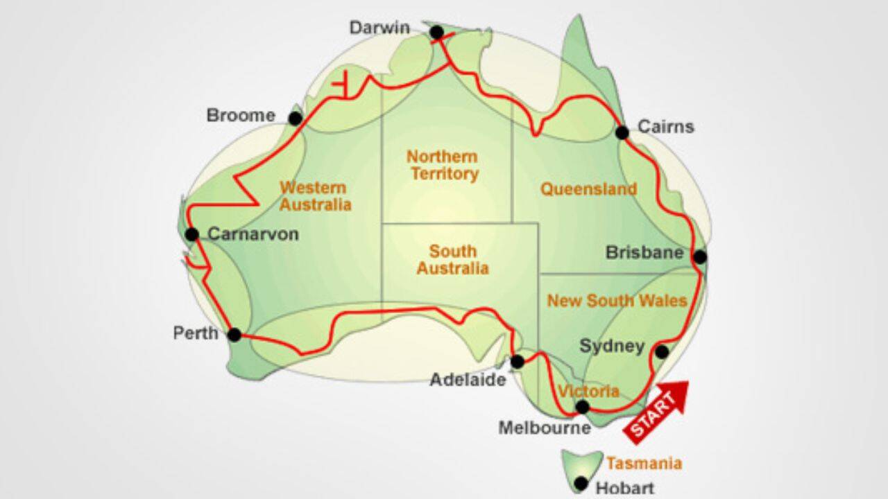
Image Credit: Continentlist.com
The ‘Big Lap’ of Australia
In their local culture, driving through the entire length of Highway 1 is known as the ‘Big Lap.’ The Cooee Tours guide for 2026 describes this journey as the ultimate Australian road trip, covering around the mainland and sometimes extending to Tasmania via ferry. The official length of the highway is roughly 14,500 kilometres, but most travellers end up covering between 25,000 and 30,000 kilometres once they include the side trips and detours to iconic spots like the Kimberley or the Red Centre.The guide suggests that completing the full circuit properly requires anywhere from 3-12 months, because road trip fatigue is a very real factor on such long stretches of highway. Today, the entire route is fully sealed, which means a standard two-wheel-drive vehicle can complete the loop without a heavy-duty off-road rig. This accessibility has made the ‘Big Lap’ a preferred passage for retirees, families, and international visitors.
How this highway project was funded and completed
The infrastructure present today was largely influenced by the National Roads Act of 1974. As detailed by Ozroads, this legislation allowed the Commonwealth Government to provide 100% federal funding for a ‘National Highway’ system to ensure that the roads were constructed with high safety and standards. This was a massive challenge that involved major deviations and thousands of kilometres of bitumen covering to make sure the route was all-weather capable.Australia couldn’t claim to have a fully paved route encircling the continent until 1986, which is when the sealing of the final section of the Great Northern Highway was completed. As reported in the Ozroads archives, the federal funding model was replaced in 2005 by the Auslink program, but these routes still kept their strategic importance as the most favourable paths between capital cities. The green and gold shields which are used to mark these national highways still act as a guide for motorists covering the vast distances between states.

Road sign of the National Highway. Image Credit: GlidingRon/Wikipedia
Is it safe to travel on National Highway 1
Safety is a primary concern because of the extreme remoteness of certain sections like the Nullarbor Plain in South Australia. Wildlife encounters, particularly with kangaroos, emus, and wombats, are a major road hazard, especially at dawn and dusk. Travellers are advised to never drive at night in rural areas and to take breaks every two hours to manage fatigue.Despite the challenges posed by the environment, the highway network is robust. The Ozroads records and the Prokopenko study highlight that the combination of the main coastal loop with interior short-cuts makes the Australian network highly resilient. This connectivity ensures that even if one section is blocked by local disasters, the continent remains largely accessible through this grand loop design that has belted an entire continent together.